Better prepared for high water.
Raised streets and sidewalks address tides and rising seas; new drainage, treatment and the P24 pump station aim to reduce rain flooding.
New streets. Better drainage. A lot of questions.
Here’s the story behind the West Avenue improvements—and what they mean for the people who live here.
An illustration of the neighborhood’s future. Not an approved design.
Research snapshot: October 10, 2026. The latest linked construction schedule ends October 4. This guide explains the published record; it does not show live closures.
Flood resilience meets everyday comfort. These are the city’s planned benefits, dependent on the completed systems and final design.
Overall improvements budget; not the amount spent.
Varies by location; entrances and driveways must meet the new street.
West Avenue: 8 Street–Lincoln Road. Bay Road and Lincoln Court extend to Collins Canal.
Raised streets and sidewalks address tides and rising seas; new drainage, treatment and the P24 pump station aim to reduce rain flooding.
New underground pipes replace aging lines to reduce breaks and service interruptions.
Renewed, wider sidewalks, buffered bike lanes, trees and upgraded lighting improve comfort and the streetscape.
A planned Baywalk segment at 1450 Lincoln Road and street-end upgrades add waterfront connections and public space.
A few milestones from the city’s public record, followed by the work still ahead. Dates describe published updates; scheduled work is not confirmation that it happened.
A public harmonization meeting explains how raised streets would connect to existing buildings, entrances and driveways.
City project archive · May 20 public meeting
The city publishes its design-review presentation with streetscape renderings and property examples—the images shown below come from this stage.
Design Review Board · April 5 presentation
The city’s January advisory reports that pump-station work is continuing at P24, north of the post office.
City project archive · January 2024 advisory
The project team reports the pump station and Collins Canal outfall substantially complete. This describes construction progress, rather than confirmation of operation.
January 2026 progress presentation · Slide 3
As of this guide’s October 10 review, this is the latest published milestone. September 3’s update reports inspections complete for Segment 2 and approvals for the first five properties. The September 14 look-ahead still lists power, utility relocation and drainage approvals as dependencies.
September 3 update + September 14–October 4 schedule
The published dependencies include pump-station power and testing, property drainage approvals and utility relocation before road raising and harmonization. The latest schedule says the projected finish depends on drainage surveys; it does not give a confirmed overall completion date.
Published record reviewed October 10, 2026 · City timeline sources ↗
The project team is coordinating power, property connections and utility relocations. These are the key dependencies described in the latest published schedule.
January’s report called the pump station and canal outfall substantially complete. September’s schedule still listed pending FPL power work and testing affected by missing power. Construction progress does not establish that the system is operating.January report + September 14 schedule
By September 3, inspections were complete for Segment 2 and the first five properties had approvals. Road raising and harmonization were to be scheduled after all Segment 2 county permit modifications were obtained.September 3 meeting presentation
The September 14 schedule marked Alton Court sewer, drainage and watermain completion delayed pending FPL relocation. County drainage approvals and utility relocation were identified as critical dependencies for road raising.September 14–October 4 look-ahead
These are the conditions described in September’s documents. Verify today’s parking and access arrangements with official advisories.
Northern area only · Schematic, not to scale.
Markers identify places, not closure boundaries.
The new station sits in P24, beside the post office. September’s schedule reported paving and grading complete, while electrical installation and power for testing remained pending.
The next milestone to ask about: commissioning
September’s update listed no parking on Lincoln Road from Alton Road to the western street end, and on Bay Road north of Lincoln Road. Lincoln Court pedestrian bridge access was restricted during workdays, with night and weekend openings described.
Reported September 3 · Current conditions unverified
September’s presentation listed 16 Street closed between Bay Road and Alton Court, with no parking on that stretch. Water-quality wells and drainage work were underway, alongside unresolved utility conflicts on Alton Court.
Typical hours: 7 a.m.–5 p.m. weekdays; Saturdays as needed
The city has published streetscape renderings and property-specific examples. These images come from its April 2022 design-review presentation; they show proposals from that stage, rather than a confirmed final design for every property.
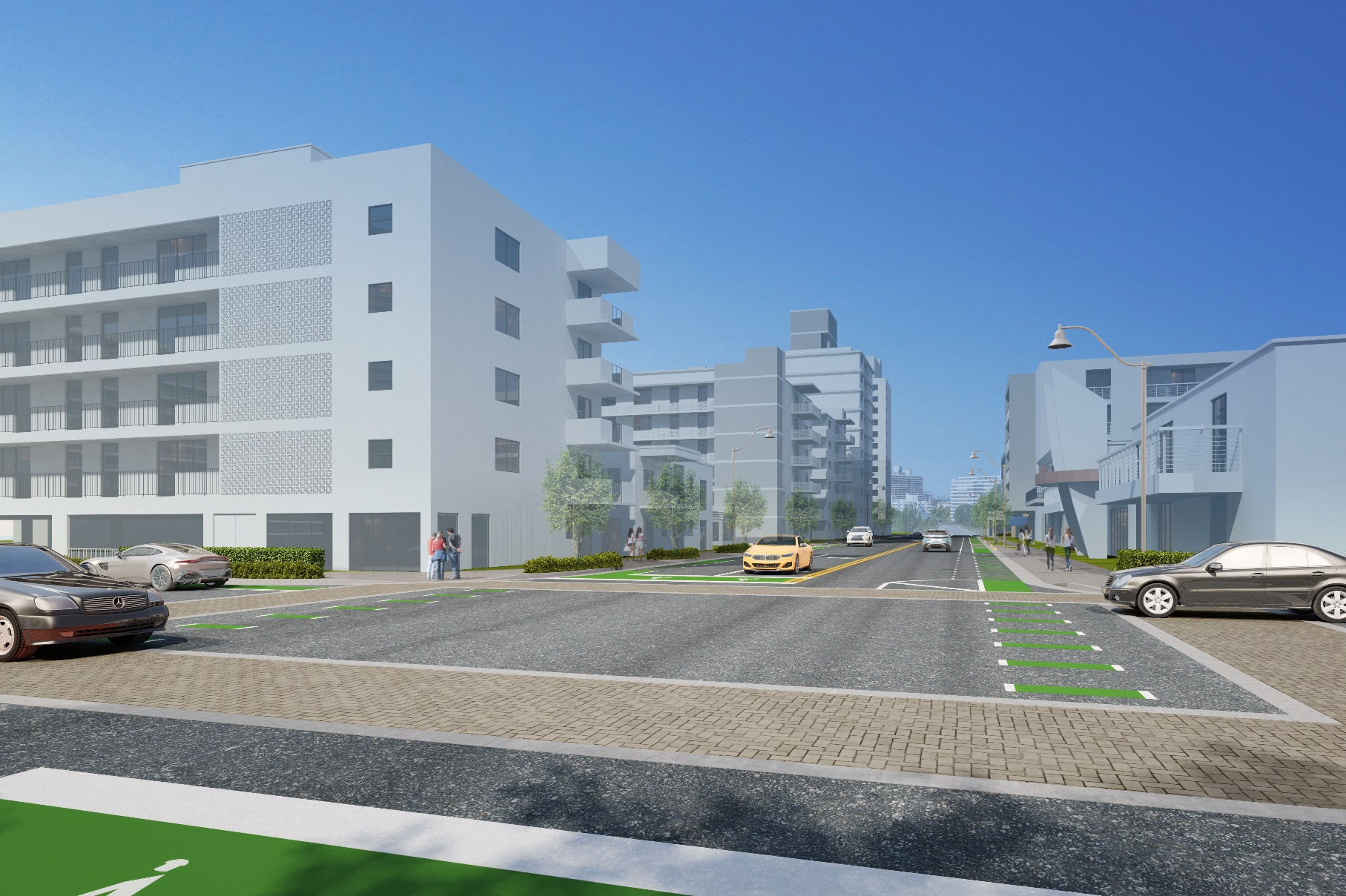
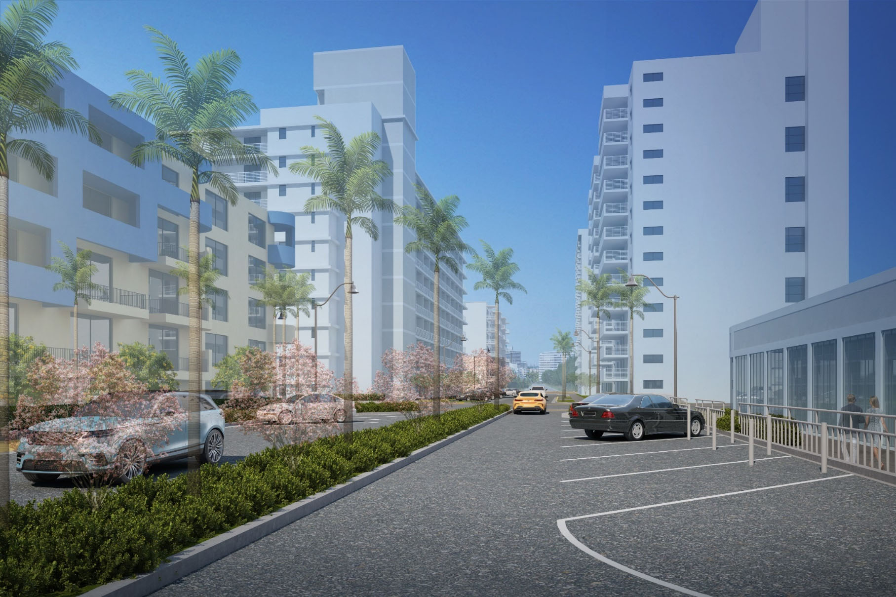
Images: City of Miami Beach, DRB21-0704 updated presentation, April 5, 2022. View the published presentation ↗
“Harmonization” connects the raised sidewalk and road to existing entrances and driveways. The city’s presentation illustrates several properties, and its May 2020 outreach materials describe a review package with a harmonization plan and customized rendering. Your building’s current package is the place to confirm its details.
The April 2022 FAQ says gates, fences or paving may need adjustments, with some costs falling to owners. Owners also retain responsibility for maintaining private drainage.
The project website also publishes April 2023 signing and pavement-marking plans, showing parking, crossings and street layouts. Those drawings predate the December 2023 mitigation proposal, so they should not be treated as the final parking arrangement.
That later proposal described approximately 102 spaces lost with about 44 returned—roughly 58 fewer under that historical proposal, rather than a verified final count.
The city publishes these contacts and channels for project information, construction alerts and neighborhood advisories.
The official West Avenue WhatsApp channel shares construction alerts, traffic updates and project notifications.
West Avenue project channel ↗Receive the city’s South Beach neighborhood and construction advisories by email.
City email-advisory subscription ↗Contacts and channels published on the official project page; Heather’s phone number is also listed in the September 2026 meeting presentation.